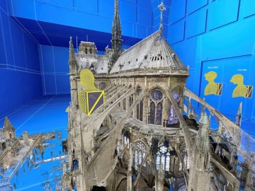
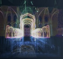
This nautical planisphere was made in 1573 by Domingos Teixeira, a member of a prominent lineage of Portuguese cartographers. It represents the extent of European knowledge after a century and a half of exploratory voyages. Only Oceania and the confines of Asia and America remained unknown. This portolan bore a strong geopolitical significance because it depicts the meridian and anti-meridian defined by the Treaty of Tordesillas in 1494 which drew a demarcation line between the areas of influence of the two main Western colonial powers of the time, Spain and Portugal.
A map kept at the French national library BnF (Bibliothèque nationale de France), Maps and Plans Department, shelf mark number GE SH ARCH-3
View this document in the digital Gallica library:
https://gallica.bnf.fr/ark:/12148/btv1b525032167
Only available for non-commercial distribution
Item No. | 6878 |
Public | Large audience |
Original Support | HD |
Version | French |
Delivery support | Digitalised File |